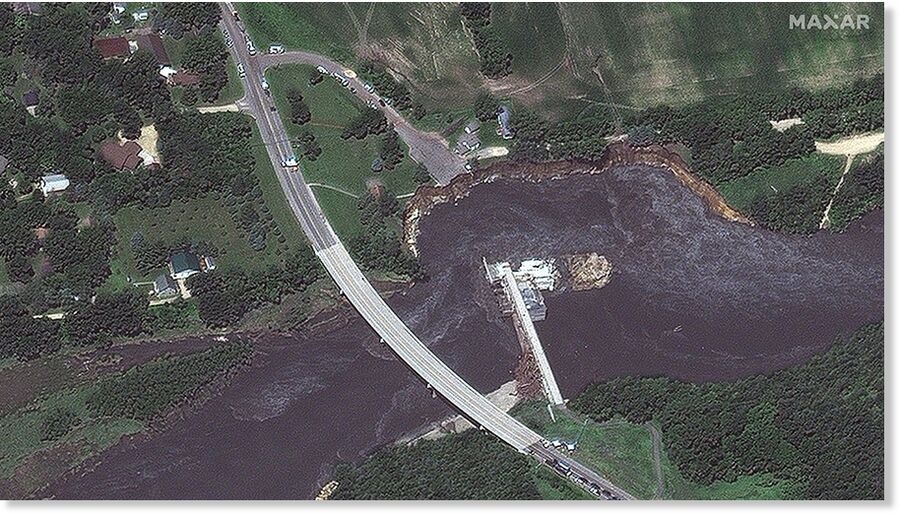
The Rapidan Dam, located south of Mankato, was built in 1910 and became threatened over the past few days after heavy rainfall caused rivers and streams to reach high flood levels and overflow their banks.
Officials had warned residents downstream from the dam of its "imminent failure" due to high water and debris flow. The water also destroyed a power substation adjacent to the dam, cutting power to hundreds of customers in the area.
Satellite imagery collected Wednesday by Maxar Technologies shows the severity of the erosion on the western riverbank next to the dam, including where the Dam Store (a white frame house) collapsed into the river earlier in the day. Additionally, piles of debris can be seen piled up along the dam's base.
On Thursday, the water levels along the Blue Earth River continued to decrease, and the flooded-out areas in the Upper Midwest are also experiencing receding water.
Now, many communities are dealing with the extensive cleanup process.


Reader Comments